|
Current Documentation - Online Help
File
Menu
Screen Procedures
Devices Mass Balances Tables Graphics Demo Case
Model Reviews & Reports P8
Applications
Windows Version 3.5
prepared without agency support
March 2015
Download
Here
Windows Version 3.4
prepared for
USEPA, Minnesota PCA &
Wisconsin DNR
October 2007
Download
Here
DOS
Versions 1.1 thru 2.4
prepared for
Narragansett Bay Project / USEPA,
Rhode Island DEM,
IEP Inc., Wisconsin DNR, et al
1990 - 2000
A B S T R A C T - Version
1.1 - 1990
P8 is a model for predicting the generation and transport of stormwater
runoff pollutants in urban watersheds. Continuous water-balance and
mass-balance calculations are performed on a user-defined system consisting
of the following elements:
- Watersheds (nonpoint source areas, up to 24 (192 in Version 2.4+)
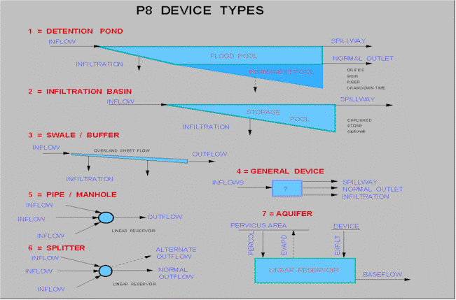
- Devices (runoff storage/treatment areas or BMP's, up to
24 (48 in Version 2.4+)
- Particle Classes (up to 5)
- Water Quality Components (up to 10)
Simulations are driven by continuous hourly rainfall and daily air
temperature time series. The model has been developed for use by engineers
and planners in designing and evaluating runoff treatment schemes for
existing or proposed urban developments. The model is initially calibrated to
predict runoff quality typical of that measured under the EPA's Nationwide
Urban Runoff Program (Athayede et al., 1983) for
Rhode Island rainfall patterns. Predicted water quality components include
suspended solids (five size fractions), total phosphorus, total Kjeldahl
nitrogen, copper, lead, zinc, and total hydrocarbons.
Primary applications include site BMP design to achieve total suspended
solids removal efficiencies (70% or 85%) recommended by the Rhode Island
Department of Environmental Management (1988). Simulated BMP types include
detention ponds (wet, dry, extended), infiltration basins, swales, and buffer
strips. Hydrologic components of the program are calibrated and tested
against six years of daily streamflow data from the 15,000-acre Hunt-Potowomut watershed, Rhode Island. The model is used to
examine the water quality implications of alternative treatment objectives.
Inputs are structured in terms which should be familiar to planners and
engineers involved in hydrologic evaluation. Several tabular and graphic
output formats are provided. The computer program runs on IBM-PC compatible
microcomputers. This report documents the structure, calibration, testing,
potential uses, and limitations of the program. A companion report (P8 Urban
Catchment Model - User's Manual, IEP Inc., 1990) provides an overview and
several example applications.
Version 1.1 - May 1990
P8 Version 1.1 was prepared for the USEPA/ RIDEM Narragansett Bay Project
& IEP Inc. in May 1990. This version is no longer
distributed. See Version 2.4
below.
Partial documentation for Version 1.1 (minus figures & tables) is
available here in PDF format. Viewing this file requires Adobe Acrobat
Reader Version 4.0 . To download partial documentation, click here: P8 Partial Documentation (Text Only), P8DOC.PDF (0.2 mb).
Complete documentation for Version 1.1 (including basic equations,
assumptions, calibration, figures, tables, etc.) is contained in file P8V1DOC.PDF (4.3 mb, Adobe
Acrobat Reader Format). A printed copy may be available from
Rhode Island Department of Environmental Management (Richard Ribb, 401-277-4914).
Version 2.0 - June 1997
P8 Version 2.0 was prepared for Wisconsin Department of Natural Resources
& Minnesota Pollution Control Agency in June 1997. Enhancements
include:
·
Snowfall/snowmelt simulation
·
Enhanced street-sweeping routine
·
Revised precipitation file format
·
Additional ASCII output formats
·
Calibrated particle files for Wisconsin
watersheds
To view documentation using Adobe Acrobat
Reader, click here: View P8 Version 2 Doc.
Version 2.0 Precipitation File Conversion
Utility - June 1997
P8CONV.ZIP (165 Kb, 6/18/97) contains a
conversion utility for creating precipitation data files to be used with P8
Versions 2.0 and higher. It supports NOAA, Earth Info, and P8 Version
1.1 file formats.
To view documentation, click here: P8CONV
Documentation.
Calibration to Wisconsin Watersheds,
prepared for Wisconsin DNR, 1997.
Version
2.1 - June 1998
P8 Version 2.1 was prepared with partial support from CH2MHill, Inc. in
June 1998. Revisions include:
·
Increase in the maximum number of watersheds
from 24 to 192.
·
Increase in the maximum number of devices from
24 to 48.
·
Provision of ASCII file input/output interface
for watershed data (potentially useful for generating model input data sets
from Geographic Information Systems).
·
Repairs of a minor bugs (plotting of
elevations, simulations with multiple storm passes, reporting of snowmelt).
Version
2.2 - October 1998
Maintenance Release. Fixed errors in 'List Peaks', aquifer recharge from
un-swept areas, and watershed index input screen. Activated case archiving
& retrieval function. No new features added.
Version
2.3 - January 1999
Format of flow calibration file (*.flo) modified
for Y2K (now uses 4-digit years). See sample file 'hunt.flo'.
Modified for use with FAT32 file system (option under Windows 98).
If P8 is stored on a disk drive that uses FAT32, input file names must be
entered directly. The option to select input files from a list is
available only with FAT file system.
The batch processing option is disabled in Version 2.3, but will be
reinstated in a future version.
Version
2.4 - February 2000
Corrected output format problems with Version 2.3 when simulating cases
with large numbers of devices and/or watersheds.
Corrected reporting of total rainfall over simulation period on menu
screen.
Revived sensitivity analysis.
File p8v24.zip (390 Kb) contains model, data
files, & documentation of program changes.
To install, expand into a convenient directory (e.g., C:\P8). See README
file for further instructions.
Complete Package - DOS
Version 2.4 and Supporting Documentation
To obtain a complete
package with the most recent version of the model & documentation, you
need to the download the following files:
·
P8V1DOC.PDF (4.2 Mb) Original documentation with
equations, assumptions, calibration, etc.
·
P8_Users_Manual.PDF (6.1 MB) Original User's Manual, Version 1.1,
instructions, sample applications
·
P8V2.PDF
(20 Kb) P8 Version 2.0 documentation update
·
P8CONV.ZIP
(165 Kb) Precipitation file conversion utility & documentation
·
P8V24.ZIP (390 Kb) Version 2.4 model & sample data files.
With instructions for using ASCII input/output interface (file P8V21.DOC).
·
Mn_Wi_P8_Climate.ZIP (300 Kb) Updated climate files for Wisconsin &
Minnesota, July 2005
Model Reviews & Applications
Following
is a compilation of articles on P8, including comparisons with other urban
runoff models:
·
Palmstrom,
N. & W. Walker, "The P8 Urban Catchment Model for Evaluating
Nonpoint Source Controls at the Local Level", Enhancing States' Lake
Management Programs, USEPA, 1990.
·
USEPA, "Compendium of
Watershed-Scale Models for TMDL Development", Office of Water,
EPA841-R-92-002, January 1992.
·
HDR Inc., "Evaluation
of Storm Water Computer Models", prepared for City of
Minneapolis, 1992.
·
USEPA,
"Compendium of Tools for Watershed Assessment & TMDL
Development", Office of Water, EPA841-B-97-006, May 1997.
Technical Support for P8 is available for a fee.
http://www.wwwalker.net/p8/index.htm
|